Old Photographs


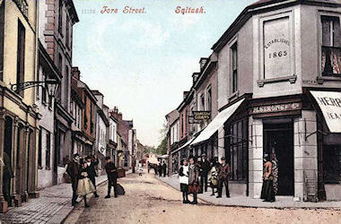
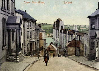
Two postcards from the early 1900s:
A narrow, cobbled Fore Street, seen from the junction with North Road, is lined closely on both sides with buildings. The corner shop in the right foreground bears the legend 'Established 1865' and its windows are shaded by low-hanging awnings, as are those of many other shops on this south-facing side of the street. A couple of gentlemen outside the Railway Hotel appear to be carrying luggage, and there are a number of other pedestrians visible, including a couple of young girls standing in the street itself which is free of vehicular traffic.Looking doown Lower Fore Street from just below the Guildhall, there are several two-storey houses on the right, sharpley stepped doen the steep street. On the left, the porticoed old Methodist Chapel, with its arched windows, sits beside a substantial three-storey house with a railed balcony-style front access. In the middle distance a steam train approaches Saltash on the Royal Albert Bridge, and part of the St Budeaux foreshore is visible in the background, with open fields behind it to the skyline.

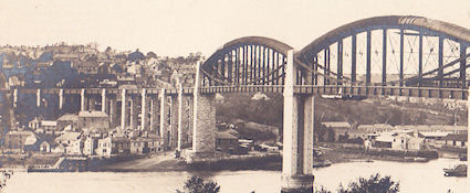
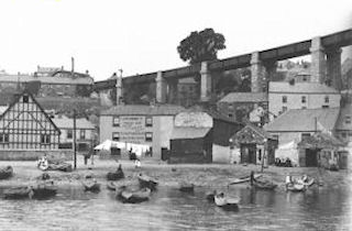
Waterside as it was until re-development in the 1960s:
Seen from the far bank of the Tamar, the huddle of old buildings around Tamar street, fronted by the old pier and flanked by the Passage House Inn and the ferry slip, are separated from the rest of the town on the hill behind by the piers of the Royal Albert Bridge. Ashtorre Wharf is framed in the arch formed by the first span of the bridge. Sand Quay, Commercial Wharf, and New Wharf can be seen to the right of the picture, below the second bridge span. The row of small houses along what is now Old Ferry Road can just be seen behind the commercial buildings at the wharfs.
There are some two dozen rowboats moored just off the beach or drawn up on land in the foreground. Behind them, what appears to be a terrace of two-storey houses is to the left of the scene, the gable end of the old half-timbered Mission Hall with its steeply-pitched roof is next, and the Union Inn can be seen to the right. Just visible from this low angle, behind and in the gaps between these buildings, are some of the houses in Tamar Street and on the hill behind.The half-timbered Mission Hall is to the left of this picture, with several old houses visible behind and in the gap between it and the Union Inn, which has a line of washing strung in front of it. To the right is a huddle of rather dilapidated old buildings, with a couple of the houses on Silver Street visible above their rooftops. The piers of the Royal Albert Bridge stretch across the background, and there are about a dozen rowboats along the water's edge in the foreground.

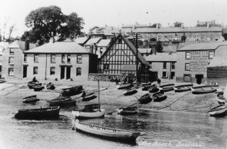
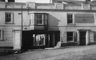
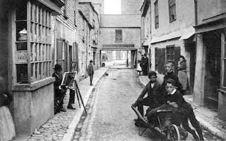
The old Passage House Inn, and Tamar Street as it was:
This close-up photo shows most of the front of the old Passage House Inn, with its second storey passing over the end of Tamar Street. Part of Tamar Street can be seen through the opening, which has a bay window above it. A doorway opens into the street to the right, below the arch, and there is another door in the right frontage, flanked on each side by a window. Above this door, between another pair of windows, the name of the Inn is painted. The whole front wall of the building is surmounted by a fancy balustrade which conceals the roof.Looking along Tamar Street from the southern end towards the Passage House Inn, there is a group of three boys with a wooden wheelbarrow in the foreground. On the narrow cobbled pavement to the left, behind the bay window of a shop, an artist sits on a low stool with his easel in front of him. The buildings fronting on the narrow street are varied in appearance, with some being whitewashed, others bare brick, and at least one slate-fronted. At the far end, the upper storey of the Inn passes over the street, with a solitary window in the centre.

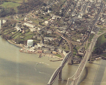
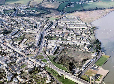
Aerial photos taken in the 1980s:
Taken from above the Tamar Bridge and looking westwards, this photo shows most of the town centre, spanning from Fore Street on the right to Coombe on the left. To anyone familiar with Saltash today, the most noticable features are the big gas tank on the foreshore where the Sailing Club is now, the lack of houses on the far side of the Coombe, the big old Baptist Chuch, and the roundabout where the tunnel entrance now is at the end of the Tamar Bridge.Taken from above the Waterside south of the bridges and looking north, this photo shows an area where there have been many changes in the last three or four decades. Towards the left are the roundabout at the end of the Tamar Bridge, the old North Road School, the old Working Men's Club, and the open area between the houses on North Road and Belle Vue Road, all now replaced by the deep cutting leading into the A38 tunnel. In the right foreground we see a large open area of allotments, now covered by a housing development. In the distance to the right is the large triangle of bare and unused reclaimed land which would later become Saltmill Park, and the open fields in the centre distance are now pierced by the A38 bypass.

Other sites with many more old photographs of Saltash:

Dave UptonForder CCAFrancis FrithRobin Cole


^ to top ^

page updated 2016-06-07

Share this page: Mail.Delicious.Digg.FaceBook.Google+.Reddit.Stumbleupon.Tumblr.Twitter